A visit to Carsulae Archeological Park’s
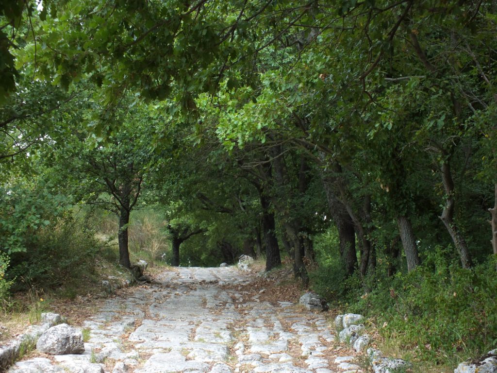
The Via Flaminia was the road that, starting from Rome, used to cross the Milvian bridge and leave the city crossing the countryside and going up along the Tiber valley to enter Umbria and continue towards Northern Italy. Along this road we also find Carsulae. Nowadays, visitors mainly reach the archeological site by car – no longer walking or riding horses – but they can still experience the same sensations: entering the town walking along the cardo maximus and looking at the great ancient buildings, sitting on the stands of the theater or strolling towards the Arch of Damiano on the Via Flaminia, as the ancient Romans did, on those same stones.
Carsulae and the Via Flaminia
Aiming to connect Rome to Southern Gaul, the Via Flaminia was traced between 220 and 2019 BC at the behest of the censor Gaio Flaminio Nepote. For a long time it was the only overland route, created for military and strategic reasons, however it soon became a lively trade route along which numerous inhabited centers arose and prospered. Among these there was also Carsulae, probably born as a staging. It was the result of the aggregation of populations coming from the surrounding countryside, who settled there to participate in exchange and trade activities.
Let’s try to imagine Carsulae: noisy, cahotic, alive and full of residents, merchants and wanderers which mingled along the paved streets. This city reached its maximum splendor in the Augustan age. Infact, during this period, important urban interventions were also made and Carsulae remained a prosperous center for a long time. However the progressive loss of importance of the Via Flaminia in favor of other communication routes led to a progressive decline and the subsequent desertion of the city. Starting from the Third Century almost nothing is known about Carsulae. We only have traces of some attempts of attack by barbarian tribes and an important seismic event, after which it was definitively abandoned, presumably around the Fifth Century.
Walking around Carsulae
Following the earthquake and the desertion, the city was gradually swallowed by vegetation. It is thank to this process that we can now walk among those meadows, with the grass made bristly by the summer sun, experiencing for a few hours the sensation of being in another time and in another world.
The archaeological site is accessed from the south, where the Via Flaminia enters the city as cardo maximus*. The paved road is bordered by crepidines (raised sidewalks) and crosses the center until it meets the decuman at the height of the forum. Then, proceeding towards the north and passing the city door, it immerses itself in the countryside towards the nearby towns.
* The Roman city developed along two main axes: the cardo, normally oriented NS, and the decuman, therefore oriented EW. At their meeting point stood the main square with the forum. Cardo and decuman divided the area into four parts called quarters.
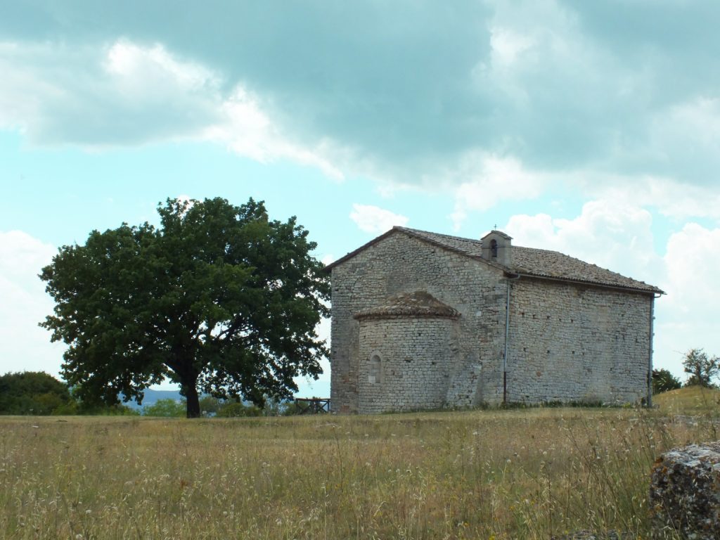
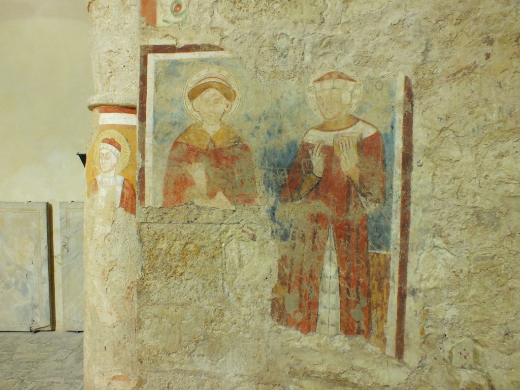
Venturing along this road visitor immediately come across the Church of the Saints Cosma and Damian which is the only Medieval building. It was built on a pre-existing construction site making extensive use of materials from other buildings in Carsulae and the interior walls are decorated with colorful frescoes representing sacred scenes.
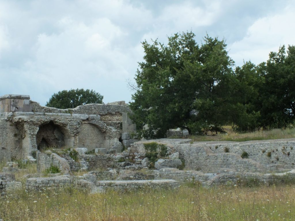
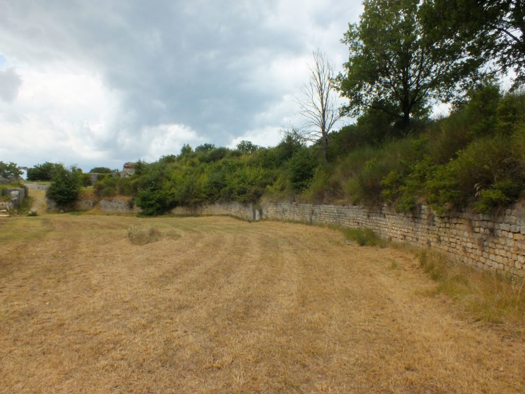
Leaving the church visitors stumble upon the remains of what might have been buildings for residences or commercial activities. On them are still visible sections of the wall or the thresholds of the doors. In front of these, a three vaulted rooms attract the attention, the tabernae. Above the tabernae there is the forum which was the political, religious, administrative and commercial center of the city. A trapezoidal square is still visible, it is overlooked by the main public buildings: the palaces of the curia to the north, two twin temples in pink stone to the south and a large portico with two four-sided arches to the east, which marked the access to the area. On the other side of the road, in front of the colonnade, visitors can admire the remains of the Basilica, datable to the beginning of the Roman Imperial period and originally accessible trough a staircase that led into the large three naves hall, as showed by the bases of the pillars that still draw the space.
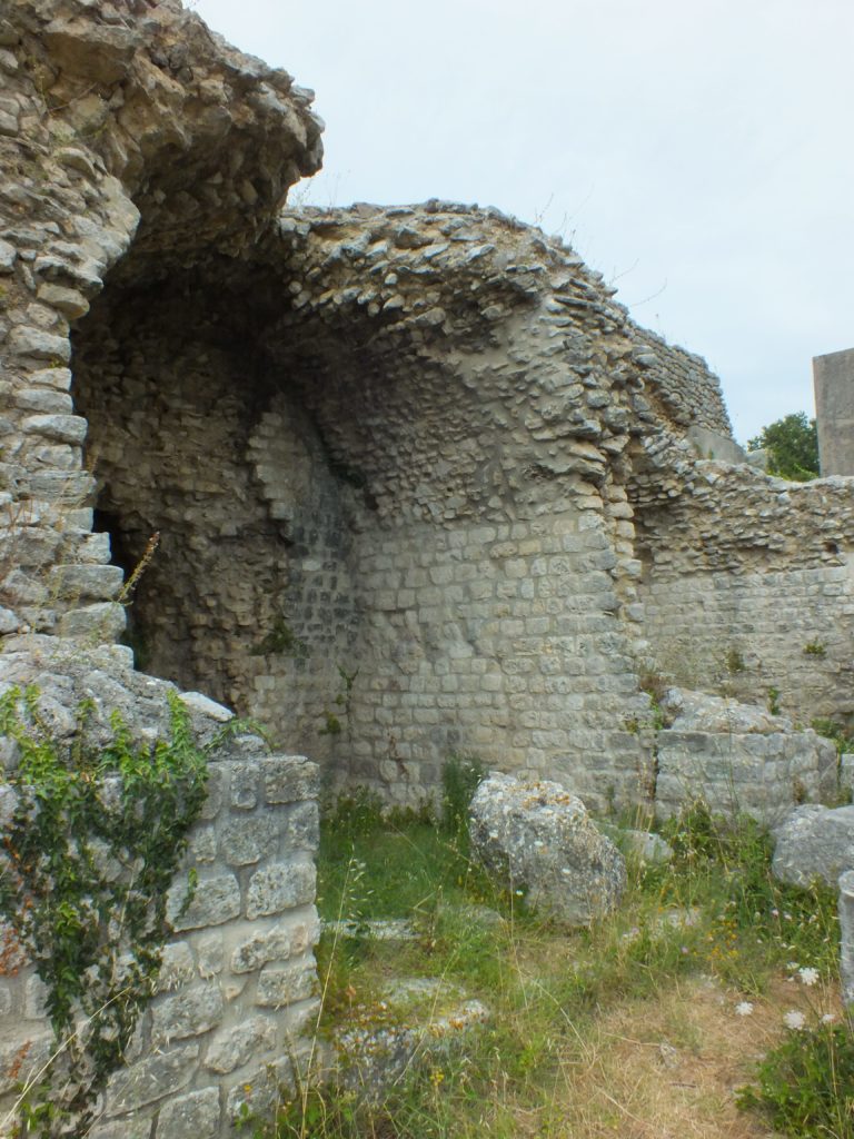
Along the decuman, in the area behind the basilica, you can see the buildings dedicated to the show: the amphitheatre and the theatre. The first one, built in a natural hollow depression, is characterized by an imposing bulk and a red brick structure that stands out against the vegetation and through whose arched openings visitors can enter the arena and experience the feeling of being in the center of the action. Just behind it, there is the theatre, entirely built in stone and above ground. Spectators can still sit down on its stands when shows are performed during summer evenings. Going back towards the main road visitors come across a building of which only some portions of the perimeter walls and some columns remain. This structure may have been a collegium iuvenes, dedicated to the education and training of young people.
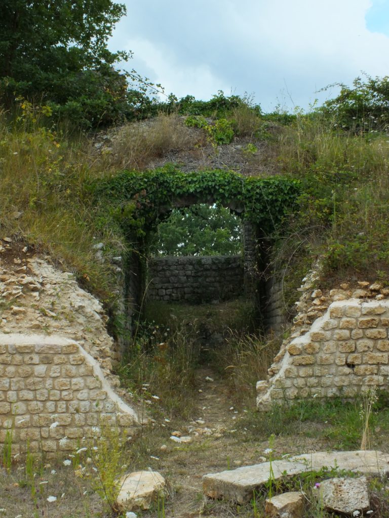
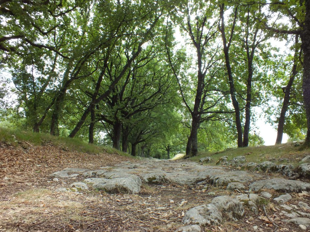
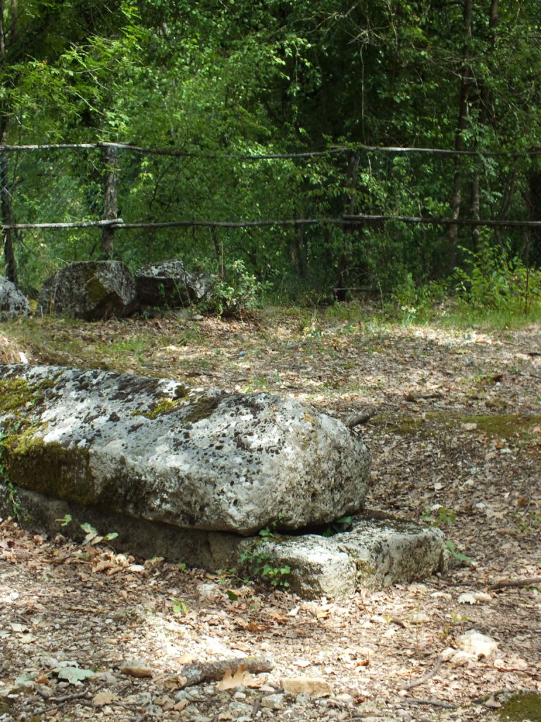
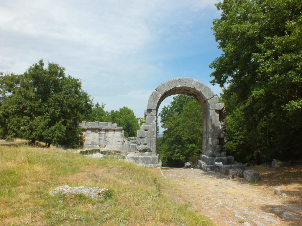
Back on the Via Flaminia and after having walked a short stretch of paved route covered by trees, visitors find themselves in a large area that frames an impressive arch with three barrel vaults: the Saint Damian’s Arch. The great arch had to be seen from the surrounding countryside and indicated the border of Carsulae. In fact, it symbolically and physically divided the city of the livings from that of the deads. A little further on visitors can venture into the woods and explore the area of funeral monuments where there is a solemnly-shaped mausoleum, a richly decorated tower tomb and the “tomb of the young girl”.
Carsulae Archeolgical site’s
What we can see today of the archaeological site of Carsulae is the result of decades – or perhaps centuries – of excavation, study and research. The first campaigns dates back to the Sixteenth Century, prosopering into the Seventeenth Century at the behest of Pope Pius VI and in the following centuries, even if in a disordered way. However, it was in the period between 1951 and 1972 that the first methodical and rigorous campaigns were carried out. These campaigns made possible to bring to light some of the most important buildings of the site, especially in the area of the forum and the theatre. In the 2000s, after a long pause, new archeological campaigns started, involving universities and international teams, and will continue for years because there are still many secrets hidden under the vegetation of Carsulae.
To walk along the Via Flaminia and imagine what a Roman city must have been like, you just have one thing to do: leave for Umbria and stop to visit Carsulae!