When speaking about the field of cultural heritage in Italy, a common complaint is the destruction of city walls all over the country at the end of the XIX century. Age-old walls were demolished, usually just to be replaced by ring roads or parks.
People look with nostalgia upon walls that have been preserved, but if you imagine what life was like a hundred years ago, when the railway boomed and the first modern systems of communication connected people and nations in a way only imagined until then, it is understandable that many cities decided to destroy their walls. Besides the need for space, there was a deeper reason: the walls personified an ancient time when your neighbour was your enemy and war was a part of everyday life. Modern people wanted to forget about this past and embrace the world, and the demolition of the walls was the best way to symbolise this spirit. Today we look at the few surviving walls with a more sensible approach to their meaning and preservation, and the cities that still have them are proud thereof. In contrast with our ancestors, we are attracted by these old relicts.
Or maybe even ancient, like the Aurelian Walls of Rome. This article will lead you on an unusual tour of the Italian capital, following what is its biggest, yet one of its most unknown and neglected monuments. People in Italy often hear about them only when the news reports a newly-collapsed piece, and this article aims to raise awareness among readers about the decay of Rome’s walls whilst at the same time providing readers with a different perspective, beyond this bad reputation.
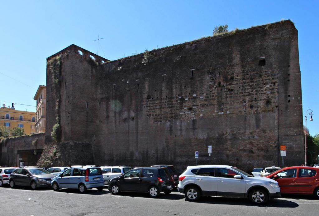
Before starting the tour, let’s have some facts, dates and figures. The walls take their name from the Emperor Aurelian who decided to build them in 270 CE: at that time the Roman Empire was affected by invasions of Germanic tribes who sacked many regions. Rome had only a primitive wall ring, the Servian Walls, dating back from the Kingdom era (6th century BCE) and protecting only the Seven Hills, but the city had grown a lot since that time, having reached a million inhabitants. The construction work was completed in 9 years and was improved upon by the Emperor Honorius in the early 5th century. Nevertheless, Rome was sacked twice: in 410 and 455 CE respectively, because the gates were, surprisingly, left open.
Most of the Aurelian Walls’ original layout dating back 1 700 years is still visible on the left bank of the Tiber river (on the right bank they were demolished in 1643 to make way for the Janiculum Walls), and following them is truly an experience through time, taking you back to Roman millennial history from the last years of the Empire (5thcentury CE) to the long Papal era (lasting from the 8th to the 19th centuries). Following the walls is a good way to get acquainted with some of the greatest heritage sites in Rome, as well as many lesser-known or “secret” places that deserve better exposure.
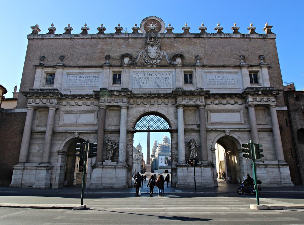
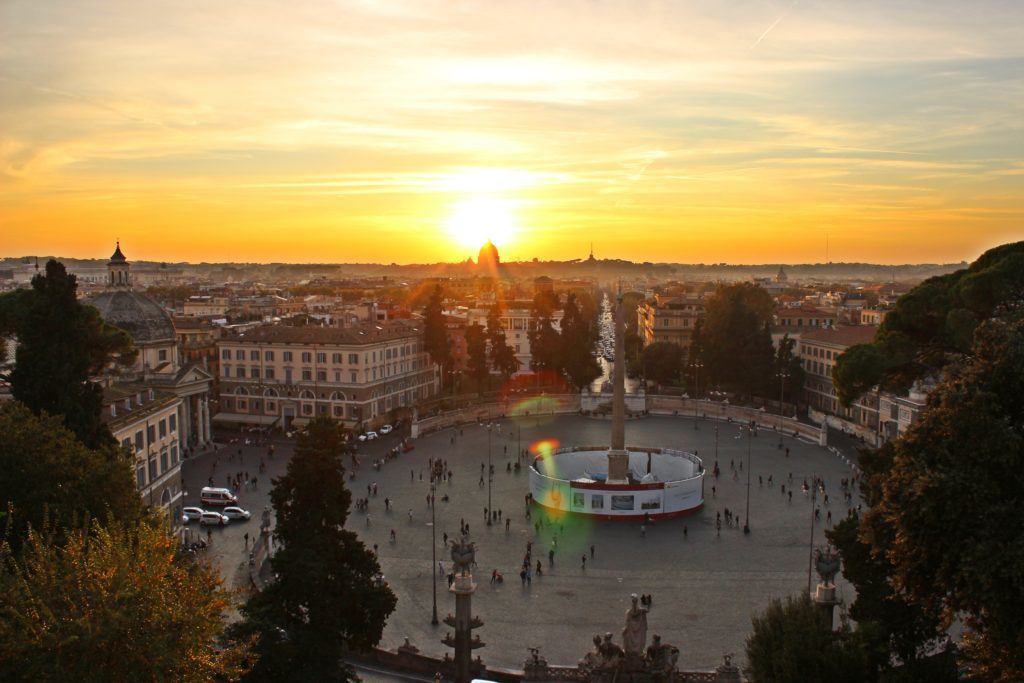
We start the tour at Porta Flaminia/del Popolo: the original Roman names of several of the walls’ gates indicated the roads passing through them, whereas the names given later under Papal rule were derived from nearby churches. In this case, the gate is named for the Via Flaminia (linking Rome with Rimini) and the nearby Basilica of S. Maria del Popolo. Porta Flaminia was monumentally rebuilt as Porta del Popolo between 1565 and 1655 by Nanni di Baccio Bigio, a famous rival of Michelangelo, and Gian Lorenzo Bernini. It is an appropriate entrance to the Piazza del Popolo, one of Rome’s most beautiful squares, which was created in 1822 after the project of Giovanni Valadier, a famous neoclassical architect and designer. It offers spectacular views from every angle, especially from the balustrade overlooking the Pincio with the dome of St. Peter’s Cathedral in the background. A carefully designed “theatre of architecture”, the Piazza del Popolo has elements from the ancient times (such as the obelisk, built during the period of Ramesses II) through to the Renaissance, Baroque and even the Neoclassical periods.
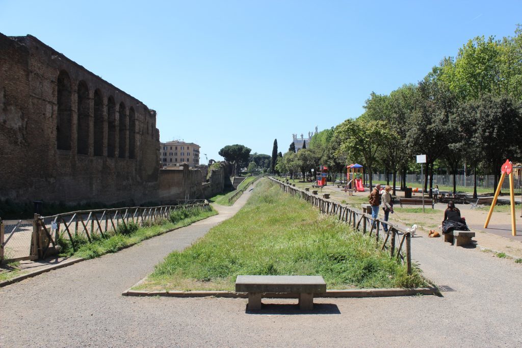
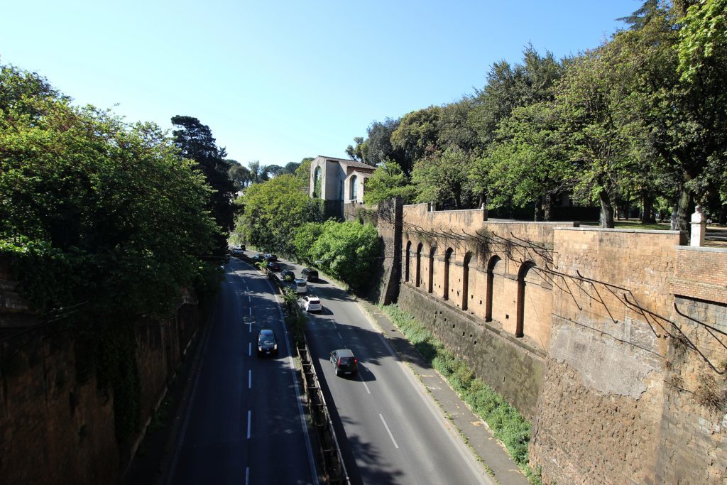
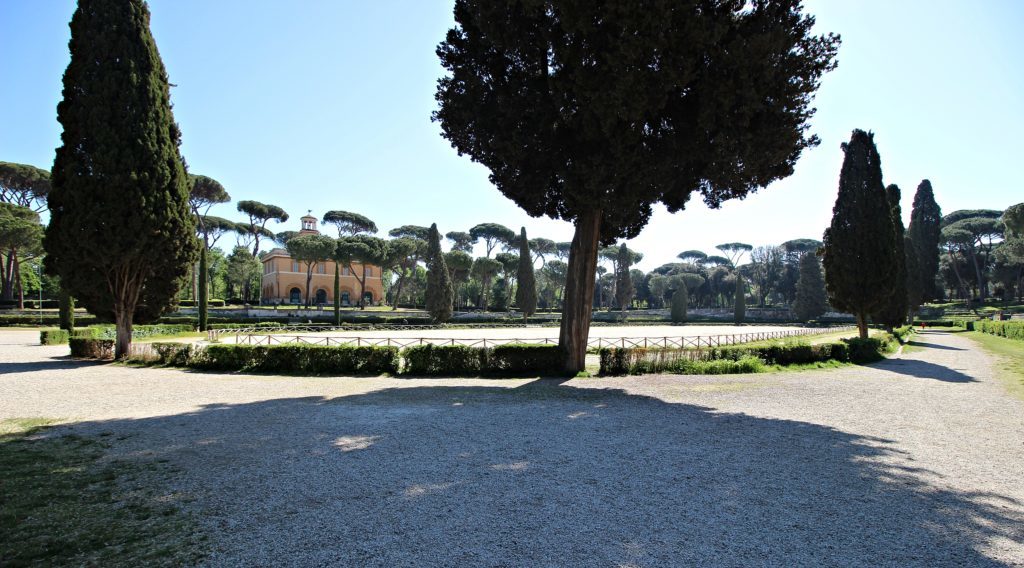
Getting back to the walls, the first section from Porta Flaminia/del Popolo, the so-called Muro Torto, cannot be followed on foot as it is part of a public road with no sidewalk. It seems however destined for neglect, as prostitutes, thieves and those who committed suicide were buried here under the Papal (Church) State. You can see it from the bridge linking the Pincio and Villa Borghese, one of the Rome’s largest parks. We walk through the latter to go to the next gate, perhaps stopping to see some of its main attractions, such as the Galleria Borghese, the National Gallery of Modern Art or even the zoo. A visit to the park itself is also recommended, as it is a wonderful example of an Italian and English garden full of squares, villas, pavilions and fountains.
Exiting southwest of Villa Borghese you see the large Porta Pinciana, the only gate of the northern walls’ section where the original “look” is still visible. Its history is linked with the famous Byzantine general Belisarius, who defeated the Ostrogoths here in 538, saving Rome from another sacking. A contested myth emerged during the Middle Ages saying that Belisarius was blinded by Emperor Justinian and sentenced to beg at Porta Pinciana. Today Porta Pinciana gives access to Via Veneto, a street flanked by luxurious palaces and cafés, all symbols of the Dolce Vita during the Sixties.
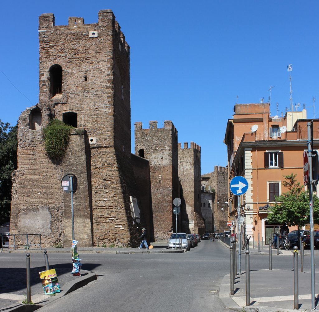
The next section of the Aurelian Walls is well preserved, with its majestic defensive towers dominating the noisy Corso Italia on the outside. Following the walls from the inner side is quieter and allows you to admire the elegant architecture of the Rione Ludovisi. Go again to the outside of the wall at the corner where Via Romagna and Via Po cross to see a cannon ball stuck into one of the last towers, a sign of the Capture of Rome. But first, pass Piazza Fiume, built in the place of the demolished Porta Salaria: on the wall here you can see a preserved latrine used by the soldiers patrolling the inner walk.
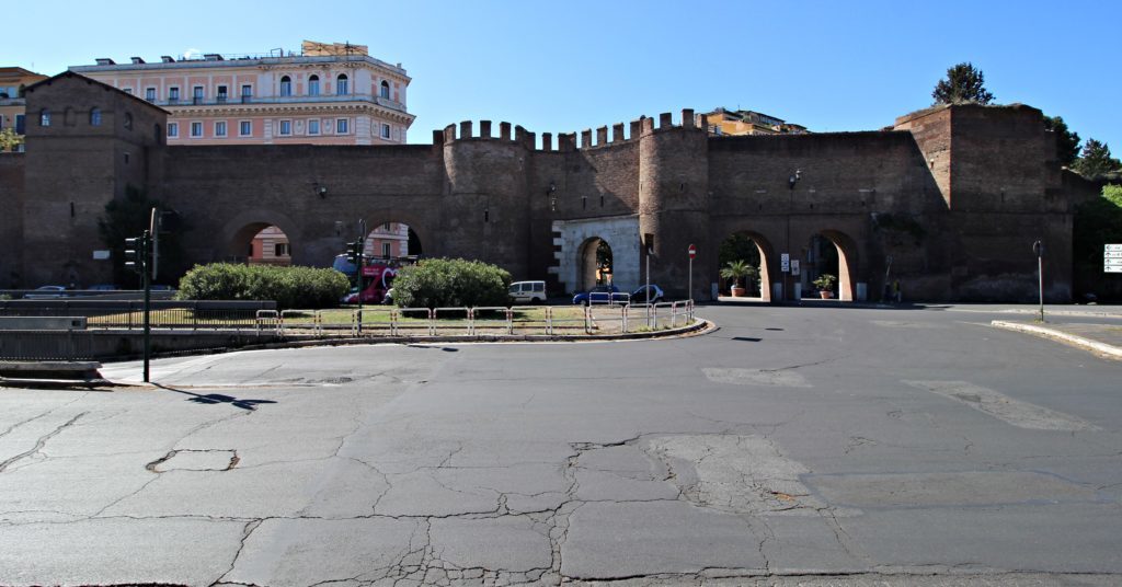
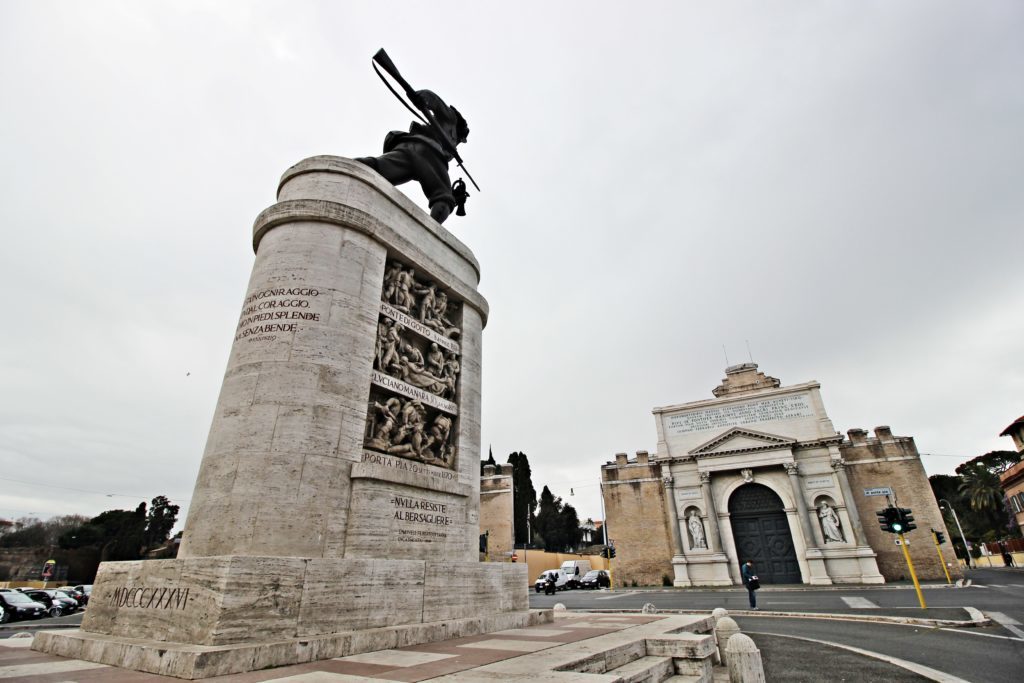
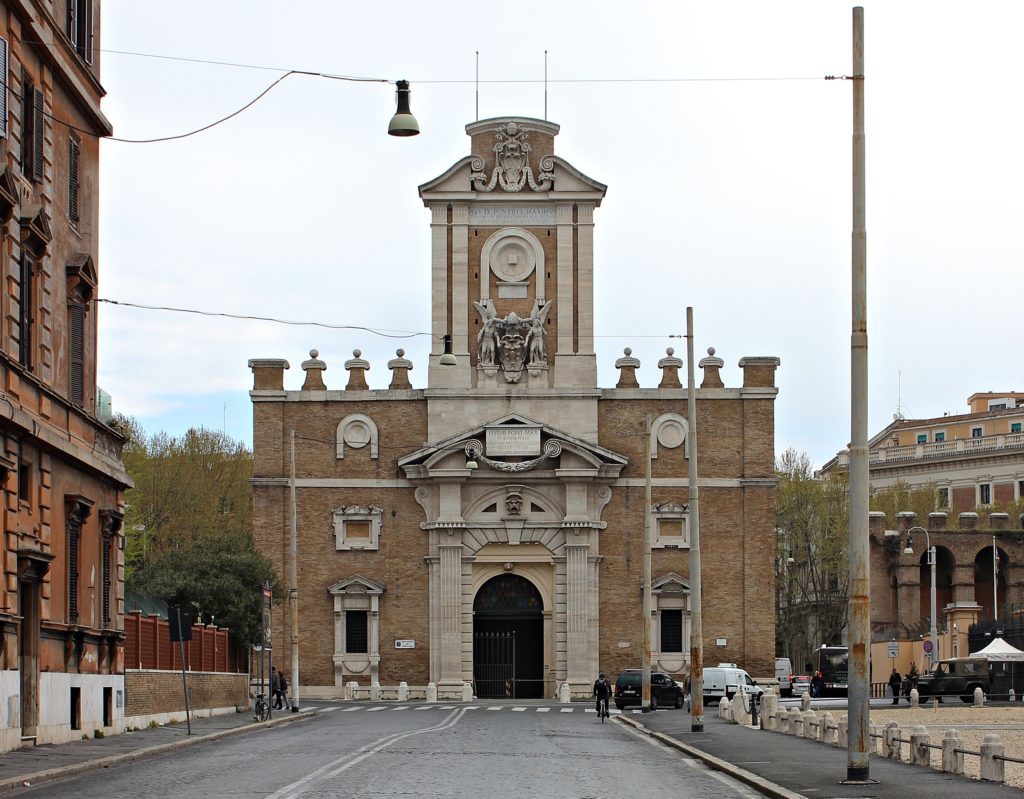
We now approach Porta Pia, built in 1565 by Pope Pius IV and designed by Michelangelo. It holds a meaningful place in Italian history: on September 20th 1870 the Bersaglieri, an elite corps of the Italian Army, breached the walls nearby (known as the “Breccia di Porta Pia”) and conquered Rome, annexing it to the Kingdom of Italy. It was the final act of the Risorgimento, the movement that led to the Unification of Italy. Consequently, it also represented the end of the Papal States after a lifetime spanning eleven centuries. Today, the breached spot is covered by a monument in remembrance of the fallen soldiers, while the gate of Porta Pia hosts the Historical Museum of the Bersaglieri. A monumental bronze Bersagliere soldier,in the assault position, dominates the trafficated square.
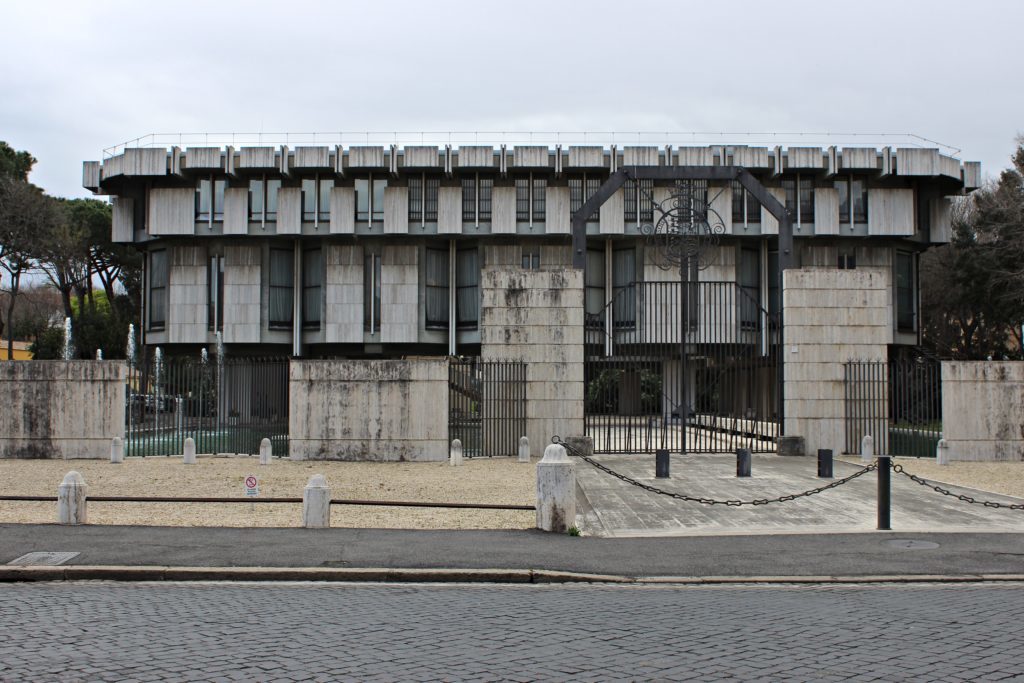
In the architectural melting pot of Rome, there is space also for some true 1970s British Brutalism. Behind Porta Pia, the grey concrete block of the British Embassy stands out from the surrounding landscape. The designer is Sir Basil Spence, a prominent English architect mostly known for the reconstruction of the Coventry Cathedral in England.
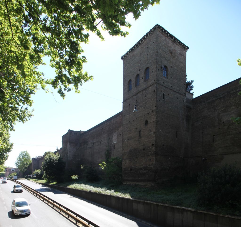
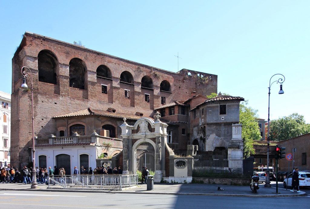
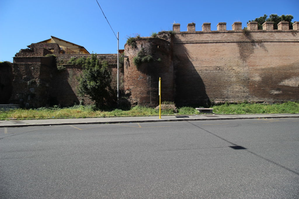
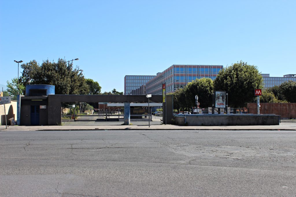
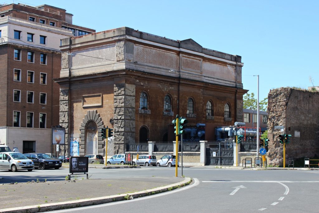
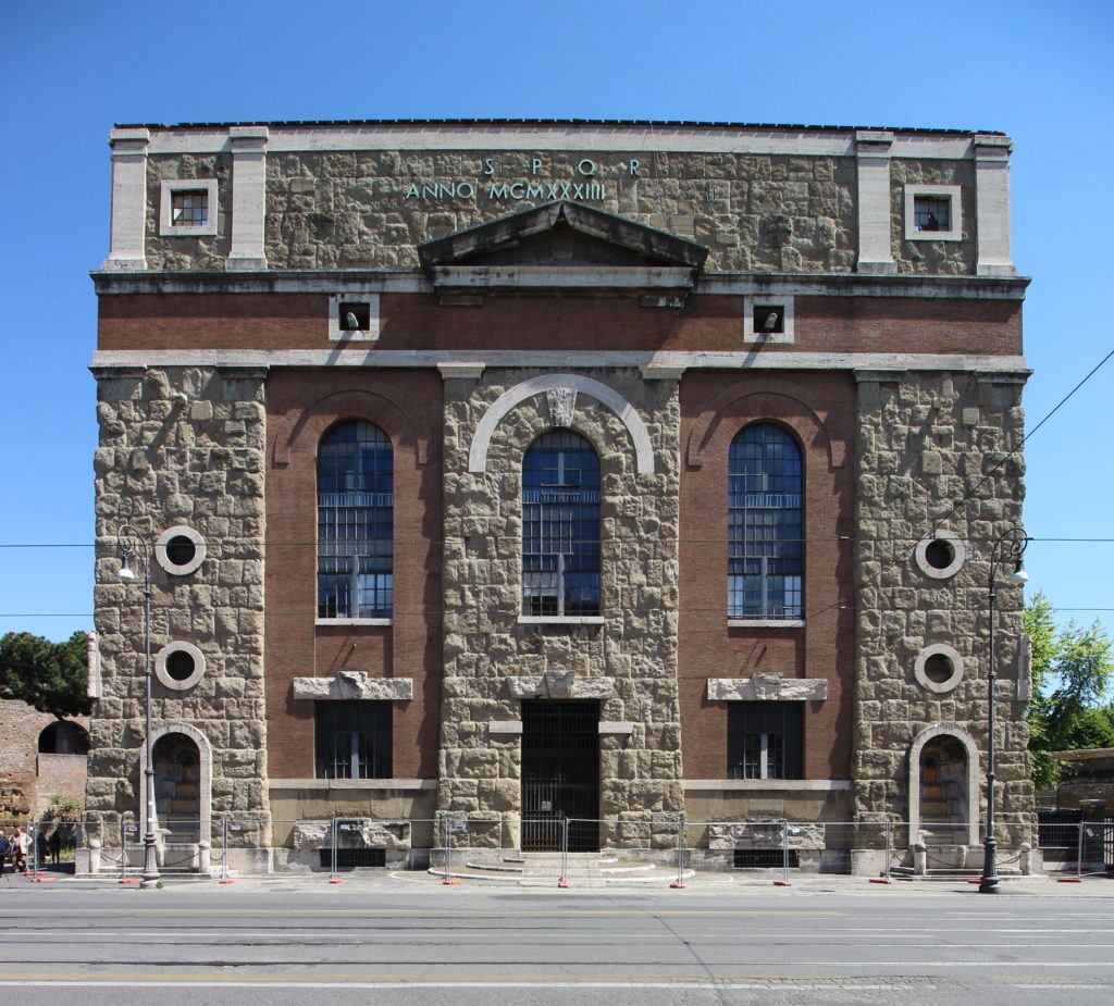
The Aurelian Walls continue their way to the Castro Pretorio, an area occupied primarily by military settlements. The name derives from the Castra Praetoria, the barracks once hosting the Praetorian Guard, the elite unit of the Roman Army in charge of the Emperor’s protection. It is fair to say that it is the oldest operating military site in the world. The modern barracks are “infiltrated” by the National Central Library, a masterpiece of the International Style built in 1975. On the opposite side, have a look at the imposing water cistern built in 1907: in Rome, even the buildings of public works are designed (at least the ones of 100 years ago) to reflect the past greatness of the city. It proudly carries the Roman motto SPQR (meaning Senatus Popolusque Romanus, The Roman Senate and People), just as the ancient temples did.
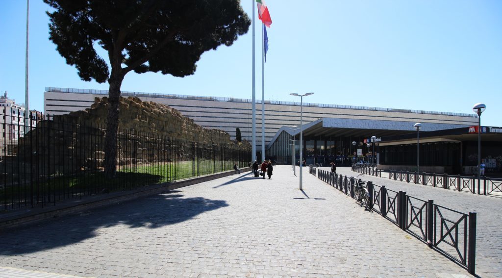
From here, the Aurelian Walls go into what is possibly their least interesting section, as they were lowered and enclosed inside private houses. We can therefore make a small detour to Termini, Rome’s main railway station. In front of it are ruins of the Servian Walls, predecessors to the Aurelian ones. This is also an occasion to look at the station, massive yet minimalist at the front, with its bold swinging cantilever canopy. It is a revision of the late 1930s project that aimed to delete the Fascist monumentalism, but the original pre-war design survives in the long side-structures marked by great arches. The grandness of the station is best-experienced drinking a coffee on the recently opened terrace, which offers a wide view of the terminal.
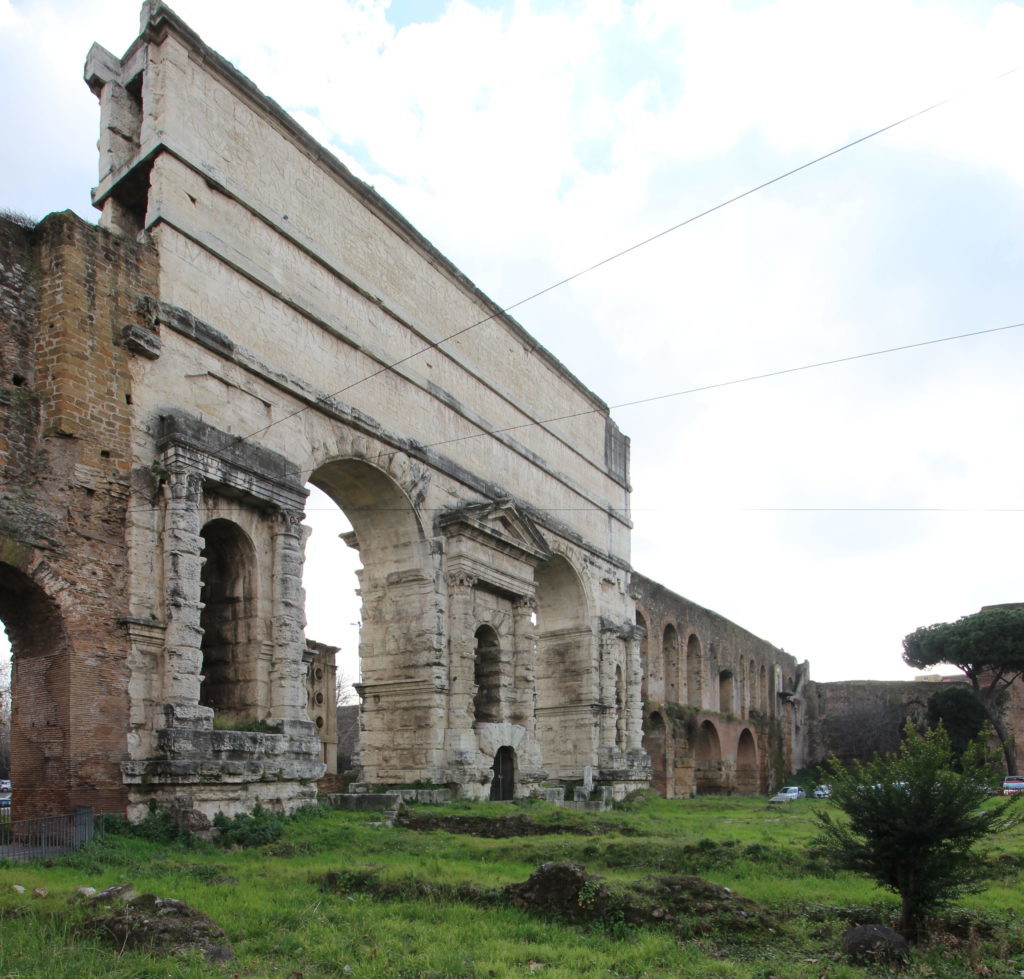
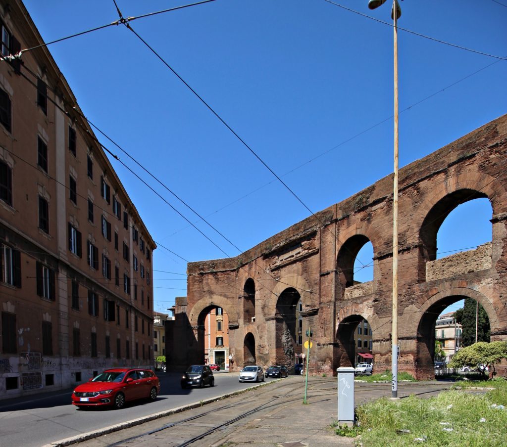
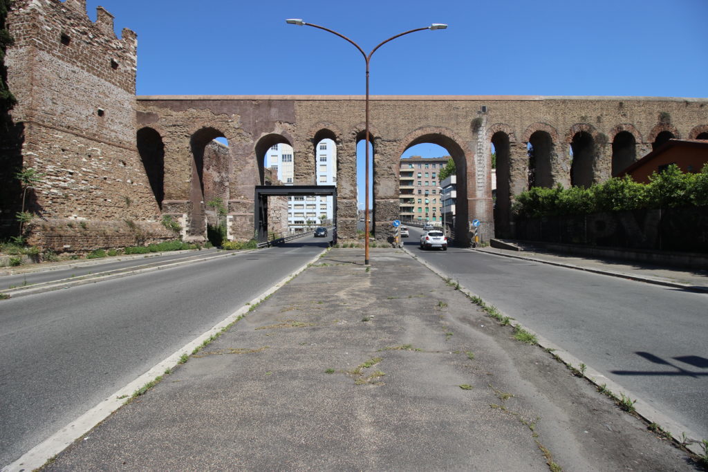
Flanking the northern side of Termini, you can steal back to the Aurelian Walls on the other side of the imposing sheds of the Army’s Artillery Headquarters. Pass through the Arch of Sixtus V, making up part of the aqueduct Acqua Felice whose features might remind you of the walls, i.e. in some stretches, they are incorporated into other structures like arches, tombs, theatres and the world-famous aqueducts that have supplied Rome with water since ancient times.
The nearby gate of Porta Tiburtina/San Lorenzo is a perfect example of this, as its arch (built by Augustus three centuries before the walls’ construction) is crossed by three aqueducts. It marks the beginning of one of the legendary Roman roads: the Via Tiburtina, named for its destination, Tivoli (Tibur in Latin).
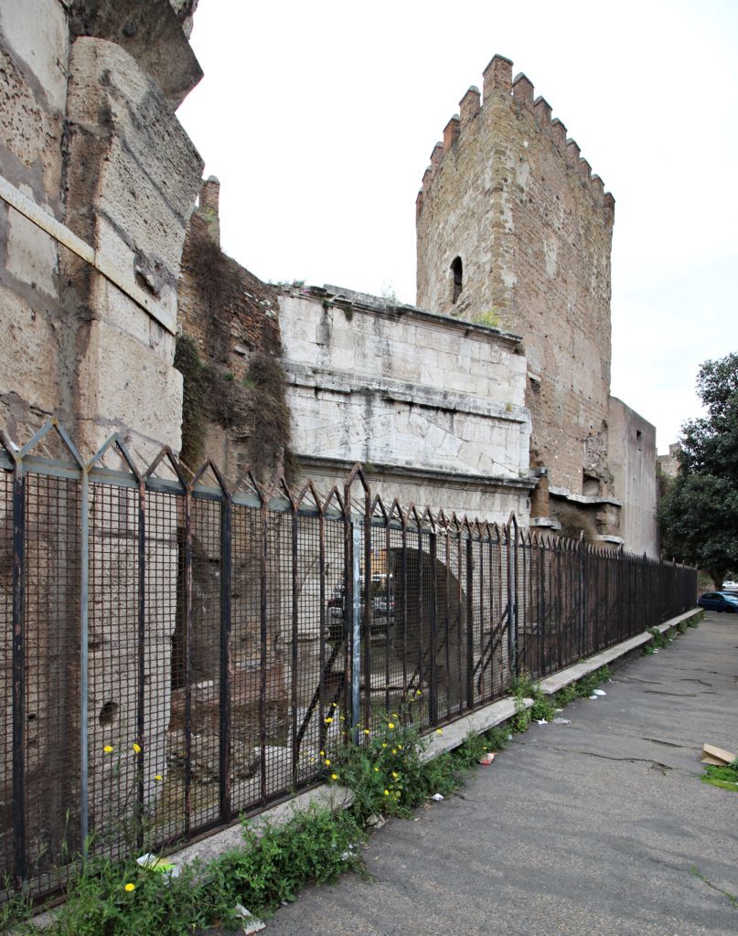
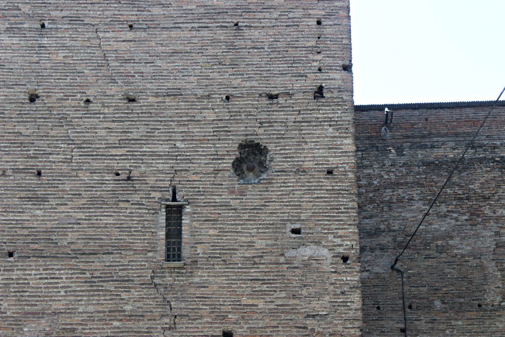
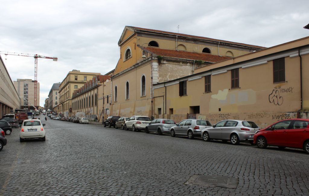
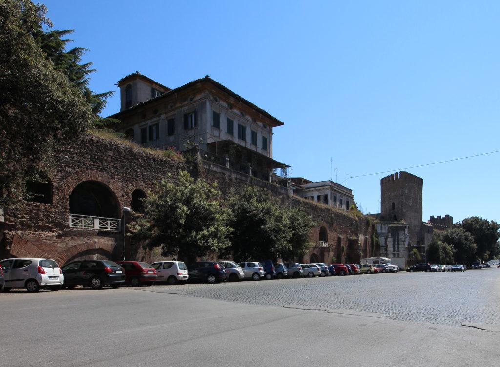
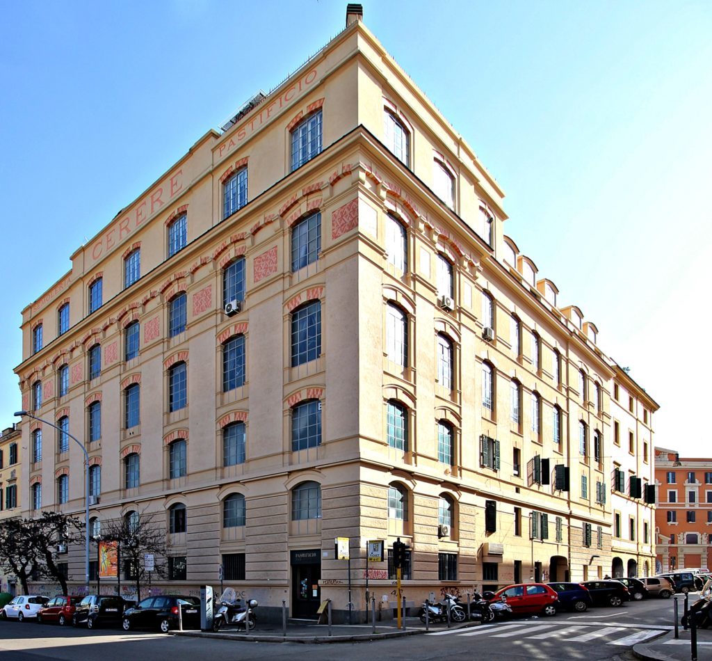
The gate also provides access to San Lorenzo, a former working-class neighbourhood which is today much appreciated by students: here you don’t find the ruins of temples or baroque palaces, but rather a post-industrial atmosphere marked by old factories like the Cerere pasta mill, now a famous contemporary art centre. Here the Aurelian Walls have become a living monument, perhaps too much so, as houses have been built over it and a lot of rubbish has started to accumulate nearby. The typical laissez-faire building politics in Italy and the lack of civic consciousness are serious threats to this monument today: built to protect Rome from its enemies, it is now put in danger by the thoughtlessness of people and authorities.
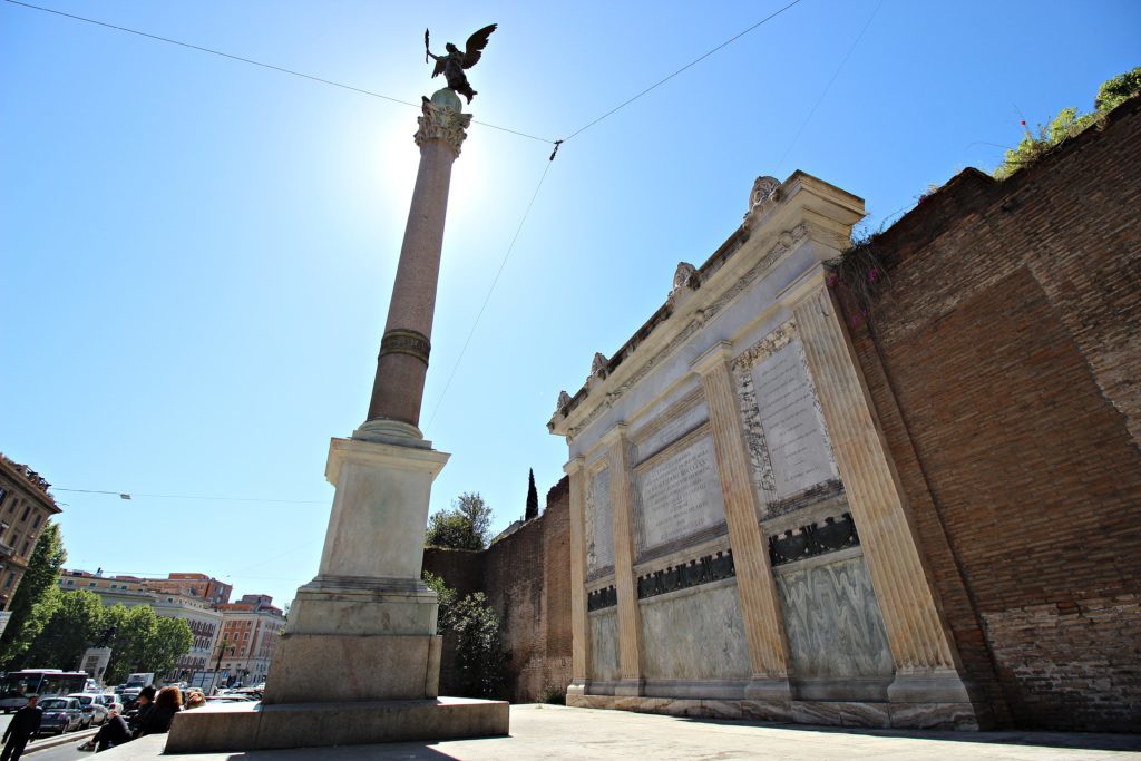
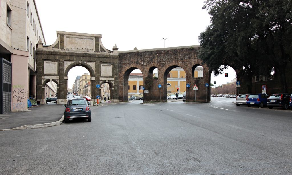
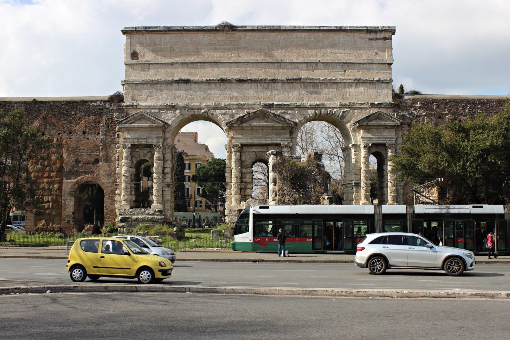
We forgive the section of the walls demolished to make place for the railway viaduct and go on to Porta Maggiore, which, as its name denotes, is a large gate. The reason for this is that eight of the eleven aqueducts that reached ancient Rome met here (look on the top of the gate to see the old ducts) and two important roads started here: Via Prenestina and Via Labicana (today Via Casilina). Emperor Claudius thought that this important crossing needed appropriate marking, and in 52 CE he had this monumental travertine gate built, which was later incorporated by the Aurelian Walls. Today Porta Maggiore is still a major crossing point, especially for Rome’s tram network: the trams passing through the ancient arches are in odd but appreciable contrast to the surrounding area, which has produced many archaeological finds. In front of the gate is the tomb of a baker, but the true hidden heritage-gem is located right under your feet: in 1917, during the construction of the railway viaduct, a collapse of the soil revealed an underground basilica from the 1st century. Finally, have a look at the Roman domus (house) inside the imposing water distribution plant along Via Eleniana.
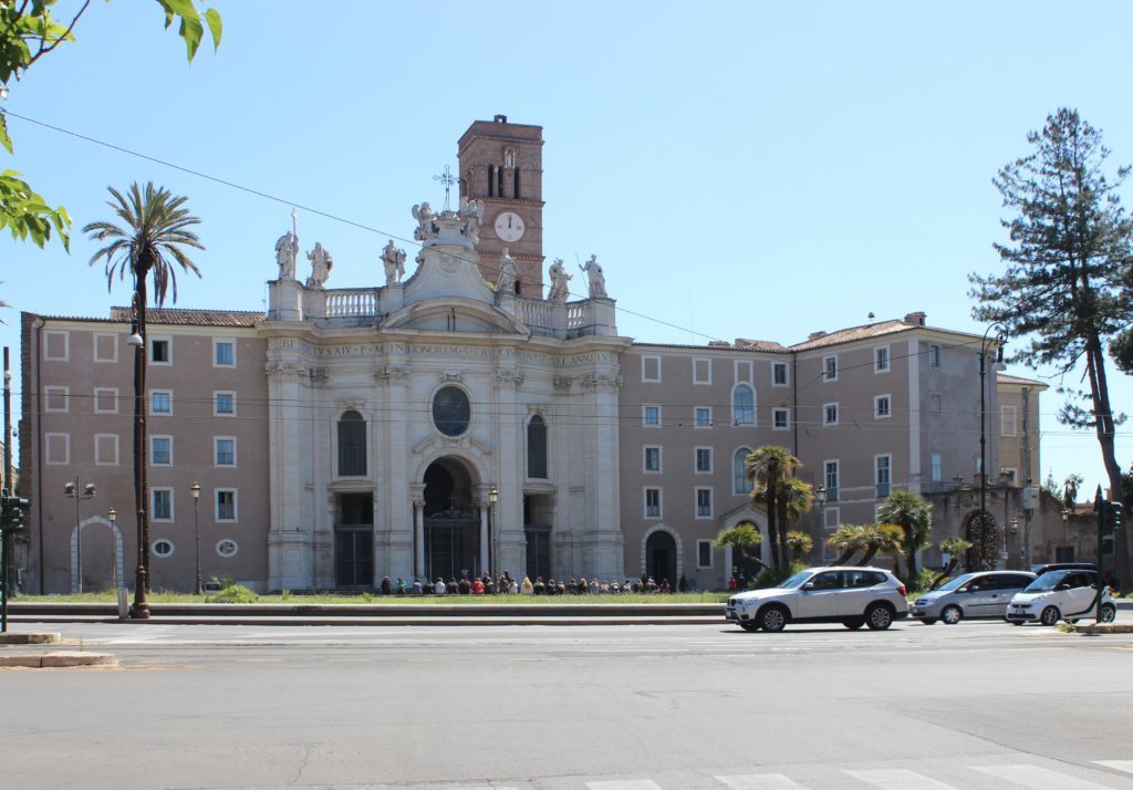
The aqueduct and the walls continue along Via Casilina, but they are not very visible here as this is currently an abandoned area. The route here is difficult to follow, but you can see the aqueduct leaving the walls as the latter turn right and deviate from the iconic arch structure. If you don’t want to follow the Aurelian Walls along the chaotic Tangenziale, you can do it from the inside, passing the complex of Santa Croce in Gerusalemme which, besides the baroque Basilica, hosts several museums (such as the National Museum of Musical Instruments, the largest of its kind in Europe) and the archaeological remains of the Sessorium Palace, the residence of Empress Helena, mother of Constantine the Great.
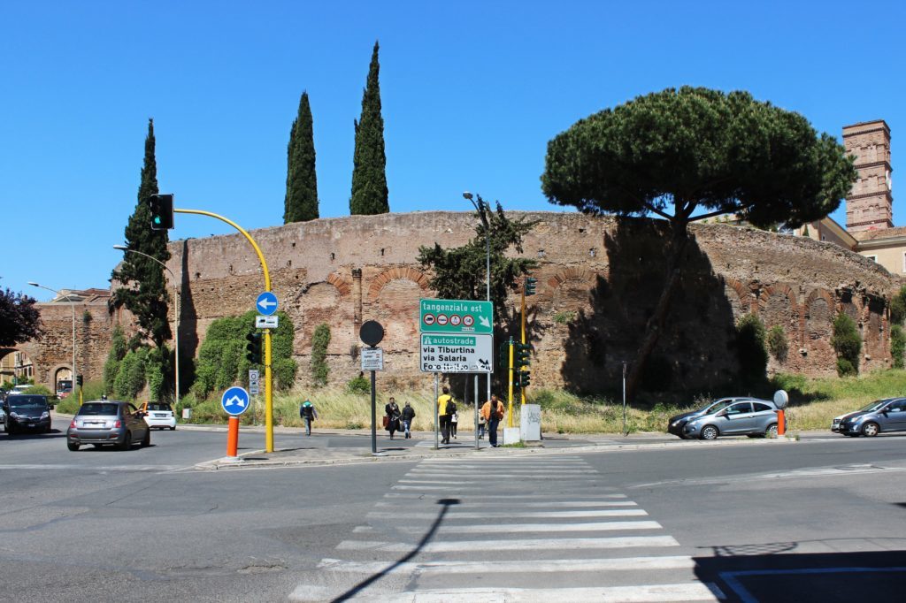
After this, you will see the Amphitheatrum Castrense, another structure that has been swallowed by the walls. Built in the early 3rd century, it is better visible from the outside with its walled arches and columns. Then you pass a well-preserved section that make up part of a park, where the typical colony of “Roman cats” crowd the ruins. You are now approaching the Lateran Basilica, from which the second part of the walk along the Aurelian Walls will start.